Five ways to discover Lake Orta
Here are all the best itineraries on Lake Orta. Discover the natural and picturesque wonders of the area.
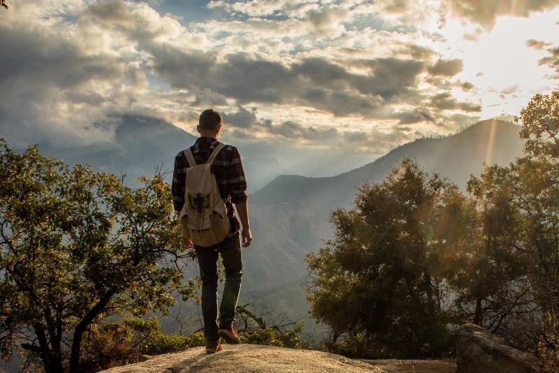
Lake Orta offers a wealth of natural and spectacular sights. Enjoy the beautiful scenery along one of the splendid walks and hiking trails dotting the area. So, let’s see which are the best trails and itineraries to discover the magic of Lake Orta.
From Orta San Giulio to Corconio
The first one starts from Orta San Giulio, in particular from Piazza Motta. Passing along Via Fava, walk on the shores of the lake on one side and gardens and parks on the other. At Villa Crespi you’ll come to Crociera and, after about 200 meters uphill, near the Santa Caterina hotel, take the narrow lane on the right, the Strada della Prisciola. This climbs up towards the sports field in Legro. After passing the railway underpass, turn right and continue until the end of the village. From here, you’ll head into the middle of the woods. When the paved road turns left and goes up towards Vacciago, go straight ahead on a slightly downhill dirt road; this is in fact the breathtaking panoramic trail offering a splendid view of Lake Orta, Monte Rosa and the Torre di Buccione. After about 90 minutes you’ll end up in Corconio. This route can be done either on foot or via mountain bike.
Girolago Anello Azzurro, connecting Orta with Pella
One of the most famous trails around Lake Orta is the Girolago Anello Azzurro, a series of trails linking some of the most beautiful villages in the area. Orta-Pella is one of such trails; it is about 14 kilometers long and connects the Sacro Monte in Orta with the small village of Pella. Starting from Sacro Monte, walk down along the regional road no. 229 towards Legro. Continue straight on after the station of Orta-Miasino along the Strada della Prisciola until you come to a dirt road heading towards the Santo Stefano church in Corconio. As you climb towards the cemetery in Corconio you’ll come across a provincial road; head downwards as far as the bridge over the railway and turn right. Just after the farmhouse, take the road that climbs up to the left.
After the Fonte Bersanella (fountain), you’ll end up on Via Artogno. Here, turn right at the stop sign and at the following one in Via Mario Motta, turn right again and continue until reaching Lido di Buccione. The small harbor on the Golfo di Buccione runs down along Via Fransisca, a dirt road. Skirting the lake, admire the natural surroundings. After about 2 kilometers, you’ll reach Cascina Fara on the right and on the left there’s a path towards the Chiesa della Madonna di Luzzara.
Going on, you’ll come to Pascolo, a small neighbourhood of San Maurizio d’Opaglio and, even further ahead, to Punta Casario. Walk along Villa Guadagnini and enjoy the view of Villa Castelnuovo. Continue on towards Lagna until you reach the provincial road no. 48. From here, turn right towards the village of Pella and, after passing Roncallo al Lago, you’ll finally reach the historic center of Pella.
Monte Cerano, the scenic trail
At 1,702 meters high, Monte Cerano provides a stunning panoramic vista of Lake Orta from where you can also marvel at Lake Maggiore, Valstrona and the Alps. From Omegna climb towards Valstrona to Germagno. At the start of the village, turn right and go on to the small church of Alpe Quaggione. From here, follow along on the asphalted road which finishes on the slopes of Monte Zuccaro. Then turn right following a well-marked path; you’ll first pass through a grove of beech trees and then continue along the ridge until you reach a junction. On the right you can go on as far as Alpe Pianello, while on the left you can continue to Morello and in the middle to Monte Cerano.
Borca-Crabbia-Agrano-Borca trail, immersed in nature
Park your car in Borca, near the church, then take the well-marked footpath just after the church and walk through a charming grove of chestnut and oak trees. Continue to the right, along a level road above the railway. After passing a few streams, you’ll reach the first homes in Crabbia. Before the church turn left; after a short paved stretch, the path leads again into the woods and ends in a pine forest. Follow the road to the cemetery of Agrano and, after passing it, take the provincial road down to the left. After a small bridge, take the path back into the woods on the left, go down for another 10 minutes and you’ll end up back on the initial path. This trail is about 7 kilometers long and takes about 3½ hours.
Alpe Quaggione, for experienced hikers
This demanding trail runs from Omegna to Alpe Quaggione, so be sure to be physically prepared. Once past the village of Crusinallo, turn towards Casale Corte Cerro. Follow for Gattugno, pass San Fermo and its sanctuary and follow on towards Montebuglio. After the village, the road climbs and there’s no time to rest. Just pass Alpe Rovelli, the crossing with Alpe Rusa and continue towards Alpe Quaggione on the right. The trail slopes considerably and even the most prepared athletes may find it tough. After more than 22 kilometers of hiking trails and 3 hours of walking, you’ll reach Alpe Quaggione. Keep going uphill on the left towards Fontanelle, where you’ll find an incredible view of Lake Orta.